
After admiring the shoreline and town centre we went hiking.

There are a few trail options once you cross the Menesetung Bridge that spans across the Maitland River.
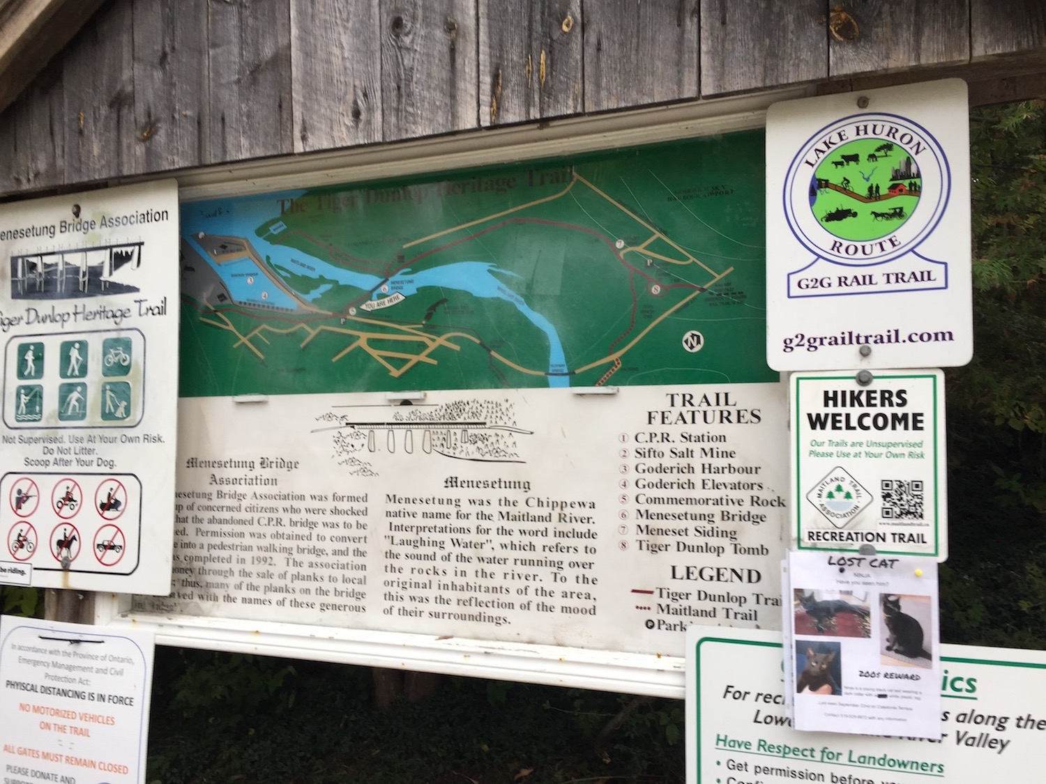
The Maitland River
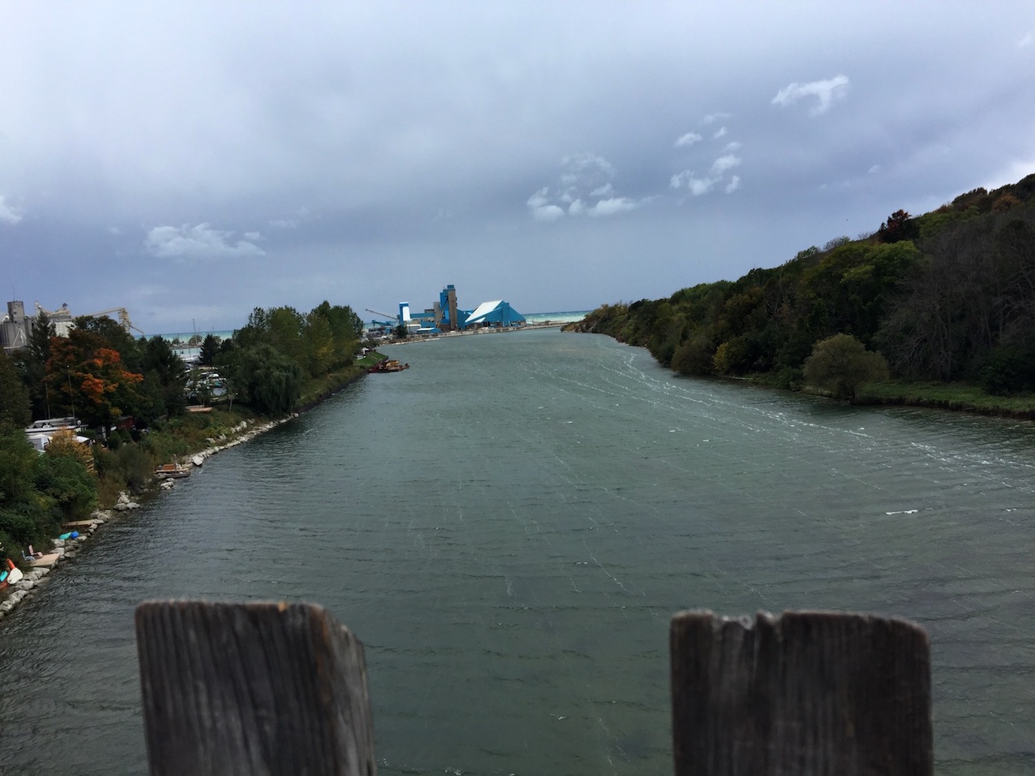
The Maitland River, also known as Menesetung river runs 150 kilometres (93 miles) before it empties into Lake Huron. You can see the salt mines at the mouth of the river. Menesetung is a Chippewa word for laughing water.
Its English name is after Sir Peregrine Maitland, Lieutenant-Governor of Upper Canada from 1818 to 1828. We thought that laughing water is a much nicer name for a river.

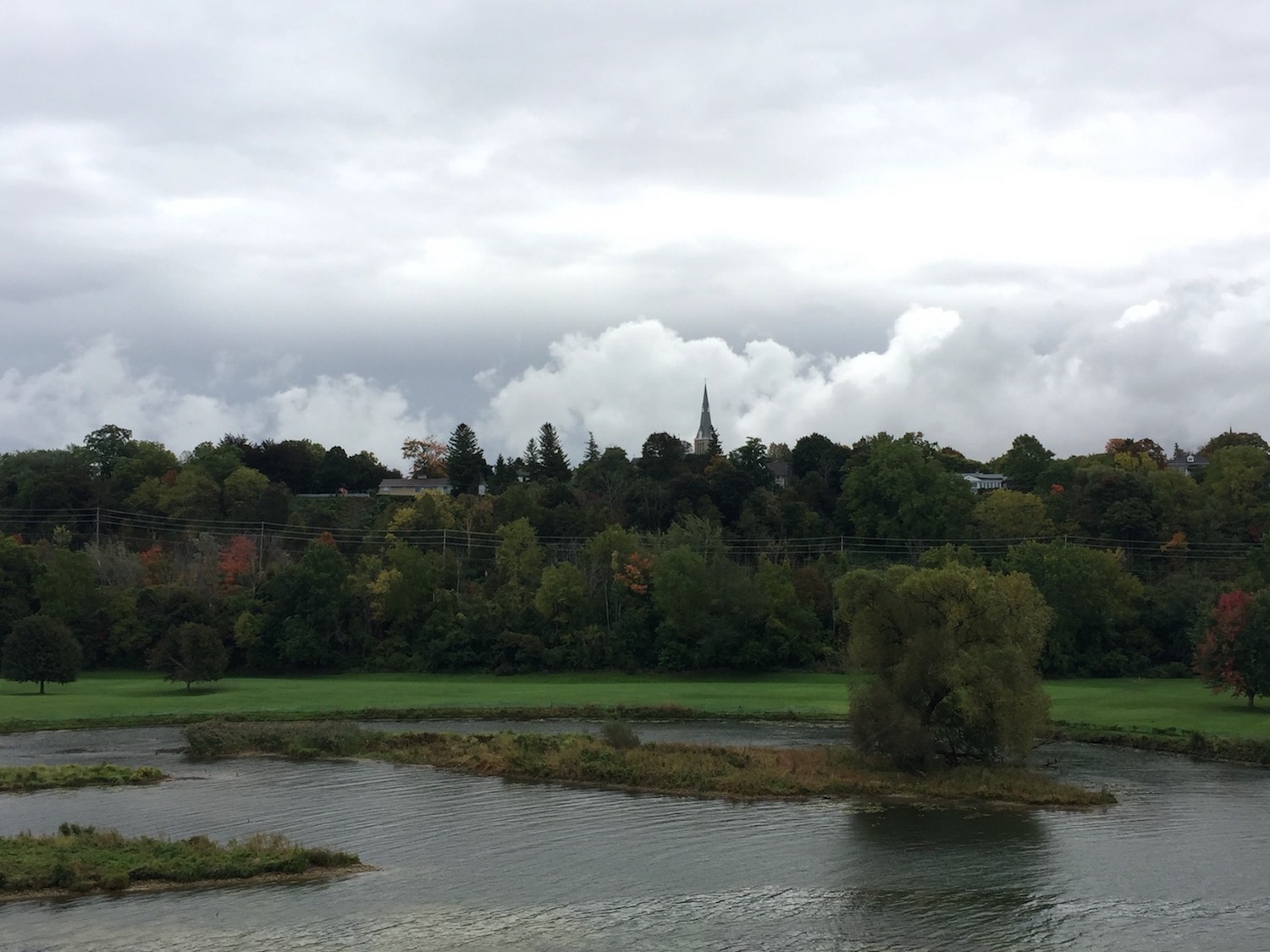
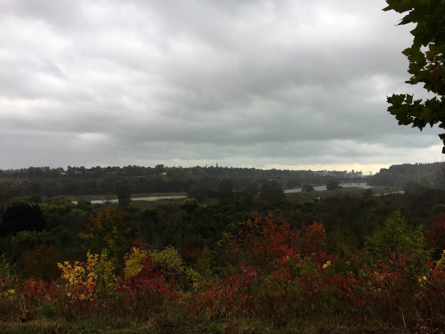
Continuing with the stormy weather theme that was the standard for this trip, we enjoyed the distant view of Goderich in fall colours.
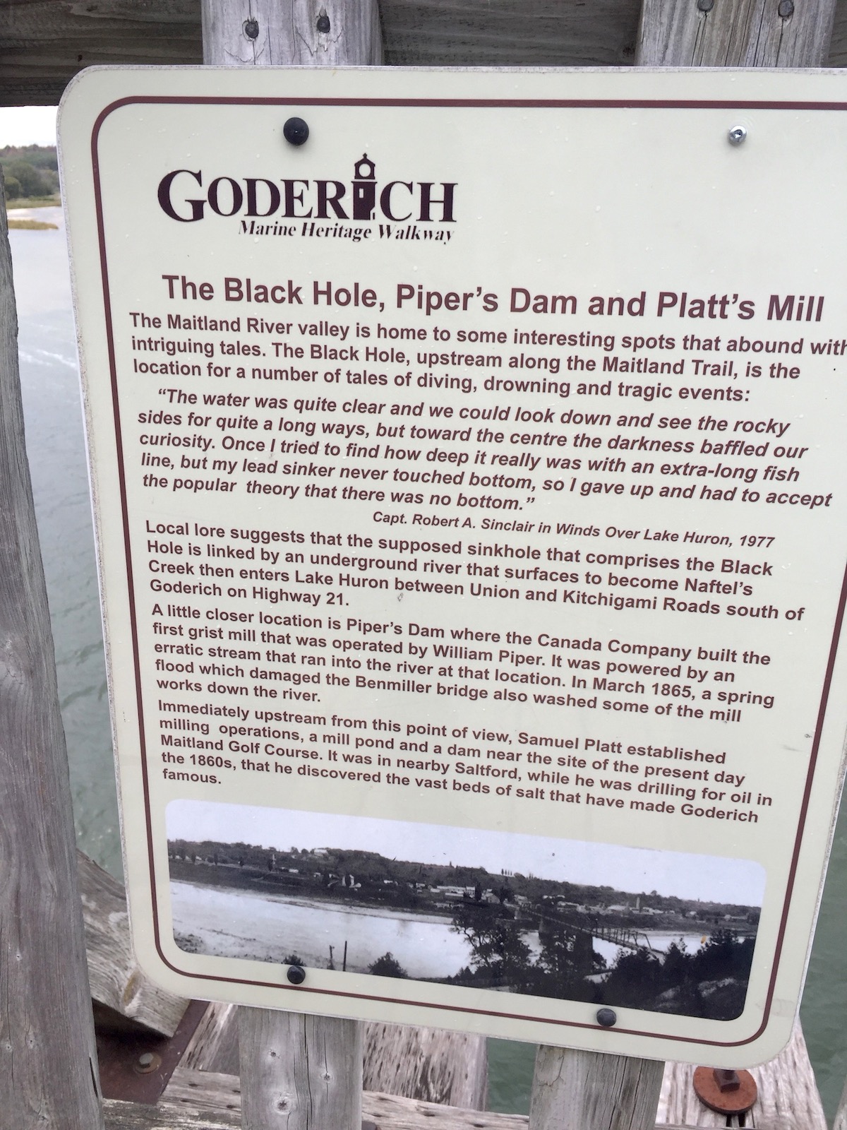
The river seems calm, but it had its share of tragedies, especially around the Black Hole that claimed several lives.
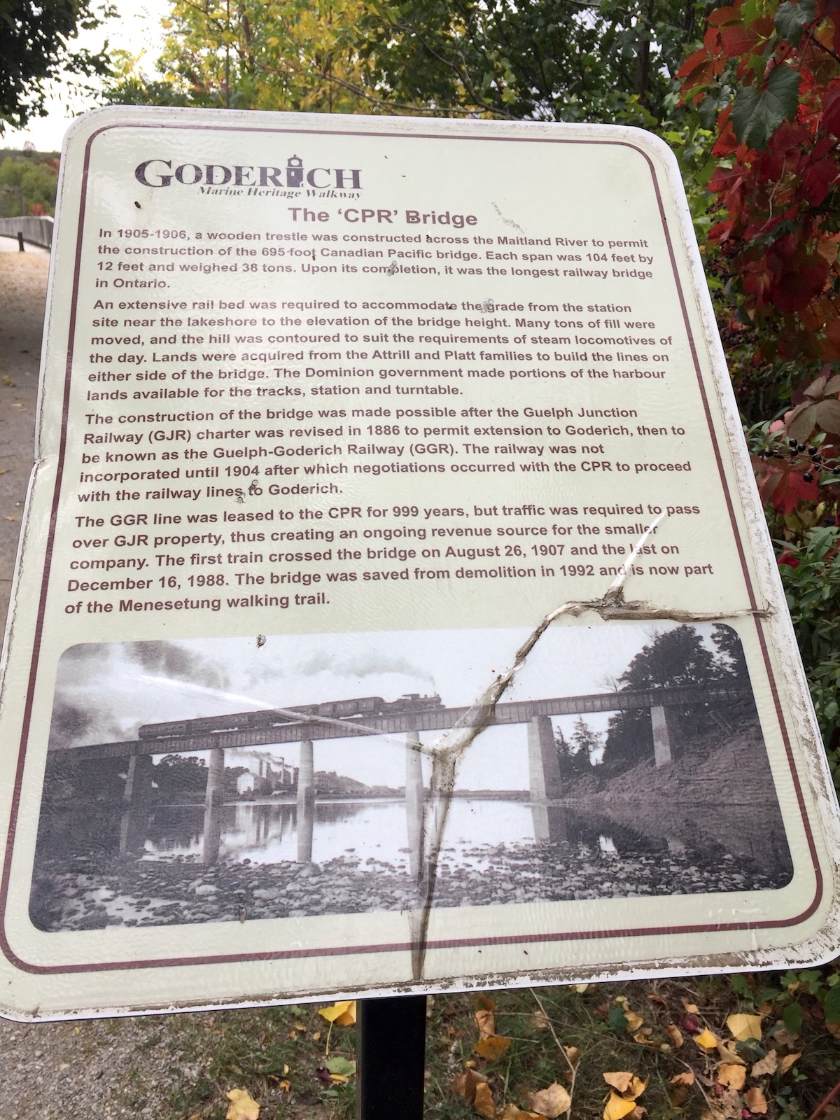
The Menesetung Bridge
The bridge has its own cool history as a railway bridge turned walking bridge. It was the longest bridge in Ontario at the time and is designated by the town for its heritage and architectural value.
The River looked especially pretty,
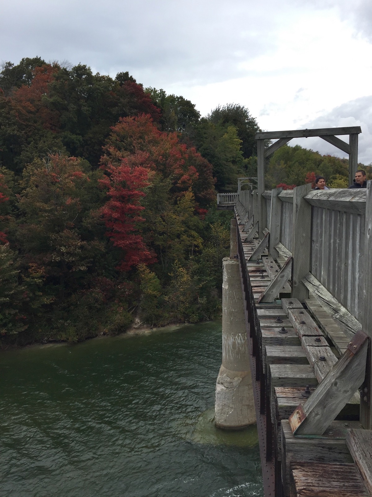
flanked with bright fall colours

on both banks.
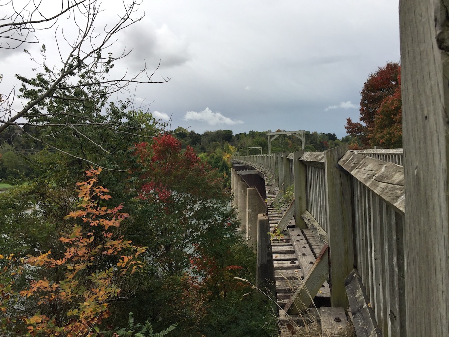
The bridge is so long and has a bit of a curve so you can’t really see from end to end.

Once we reached the other side we weighed our hiking options.
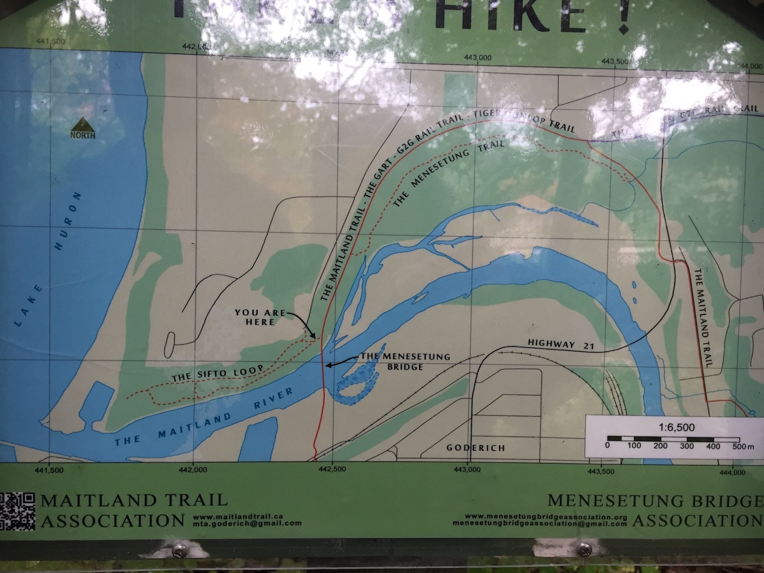
The Maitland Trail that is about 6km would have taken us to the Tiger Dunlop burial. It also connects to the G2G (Goderich to Guelph), a 127k linear former railway trail.

Not sure if the weather will hold, we opted for the Sifto Trail and enjoyed a pleasant walk through the forest and along the river bank
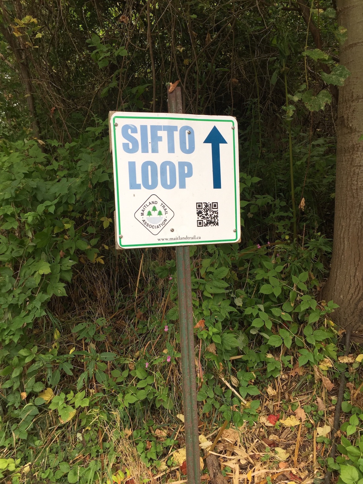
and the remnants of the Carolinian forest.
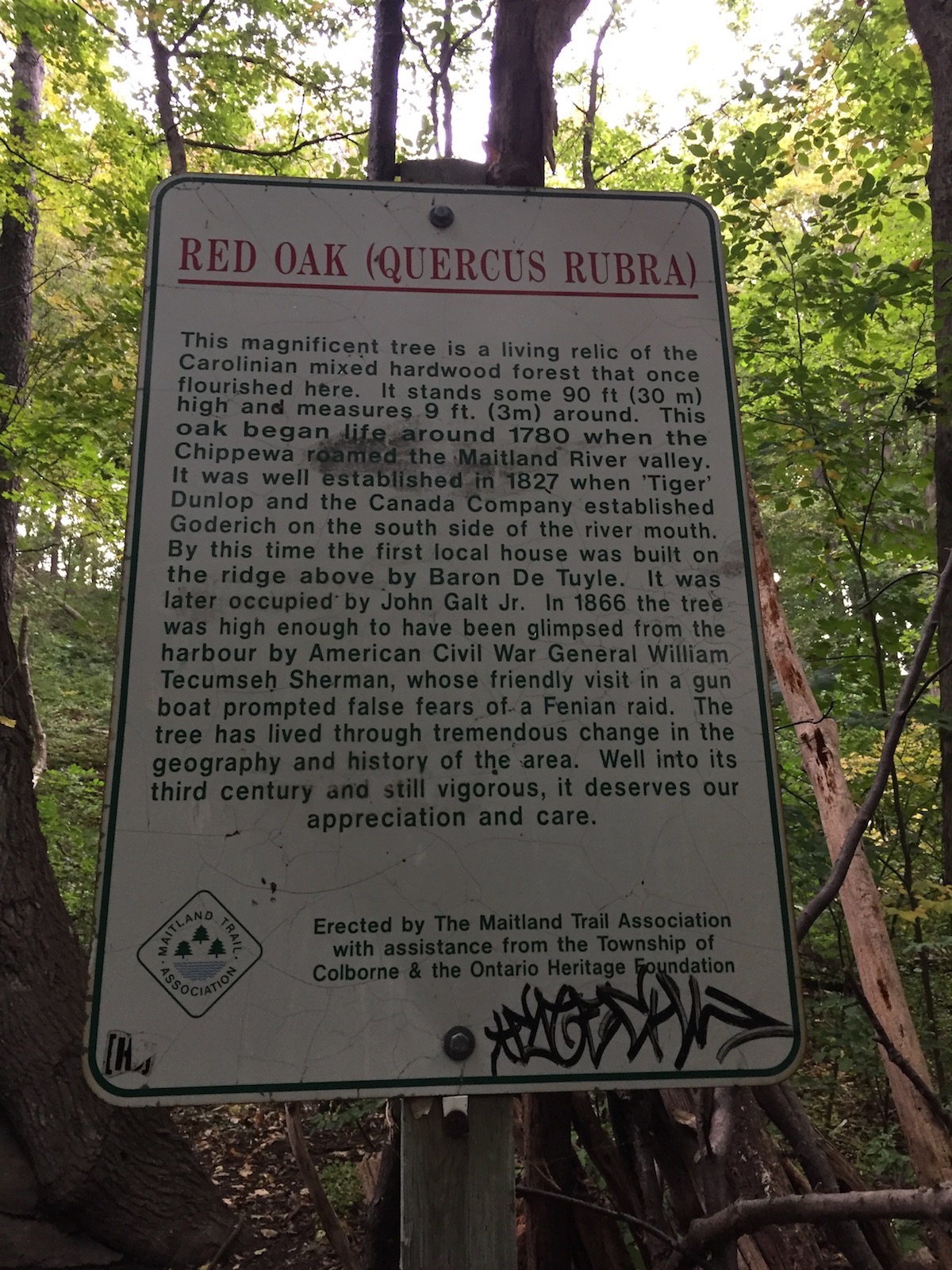
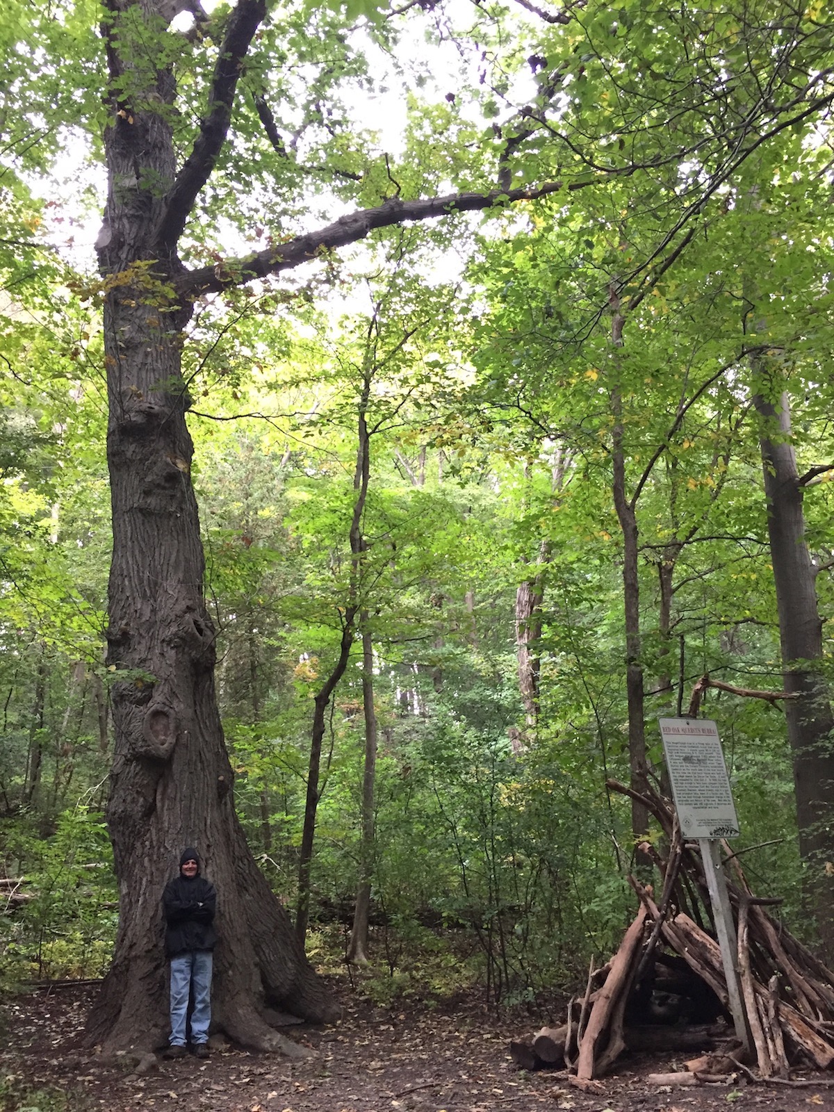
This red oak may not seem very big at first glance,
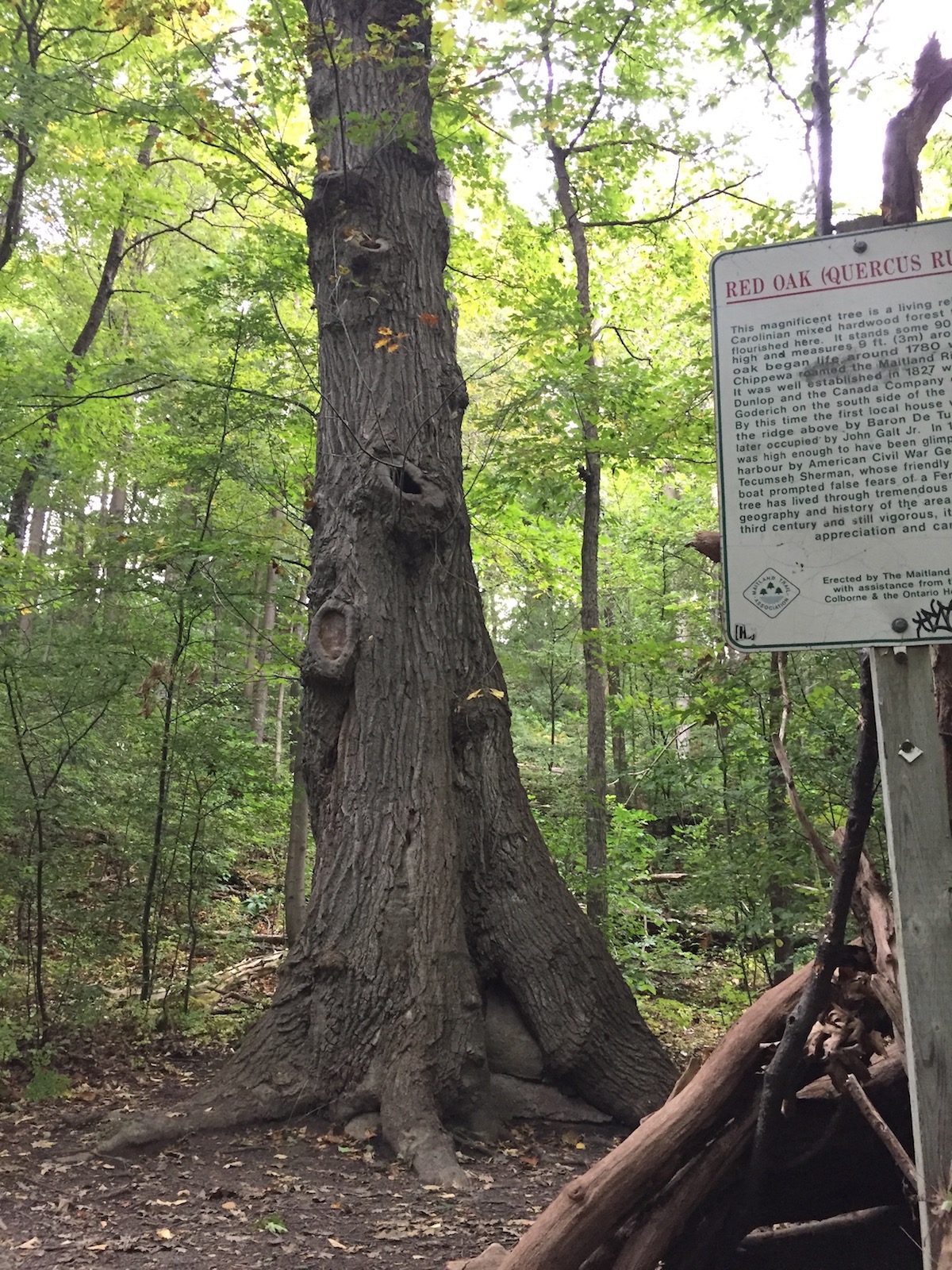
but look how small Tony looks in comparison.
Tiger Dunlop Tomb
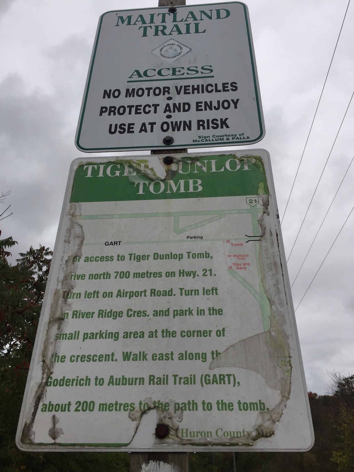
We still wanted to check out Tiger Dunlop’s burial place and decided to drive around and take the shorter trail up to the grave. What we thought to be the entry point ended up going through private property, and judging by the sign at the locked gate, we were not the first people to make this mistake.
We went back to the van and drove the short distance to the proper entry place.
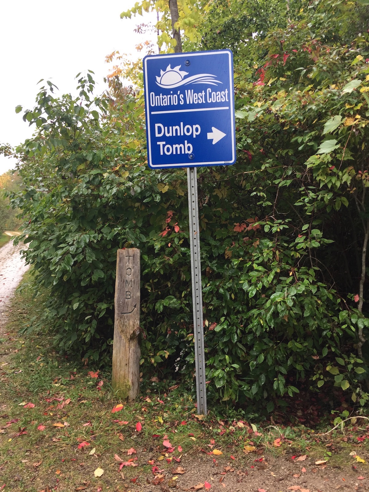
The short trail to the tomb arrived at a groomed elevated clearing

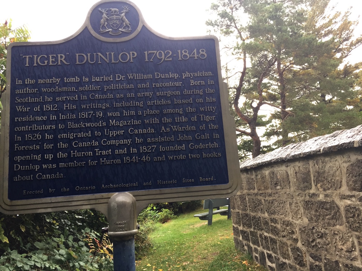
with several plaques
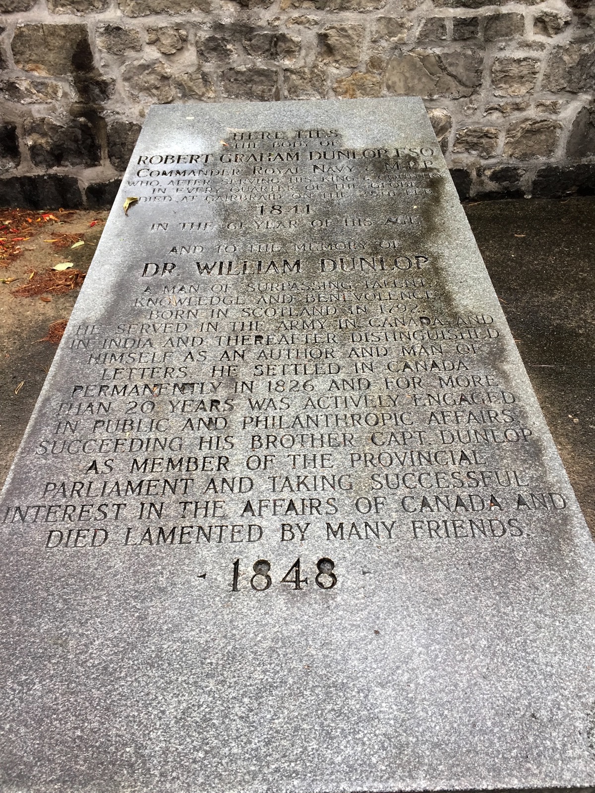
and a tomb enclosure
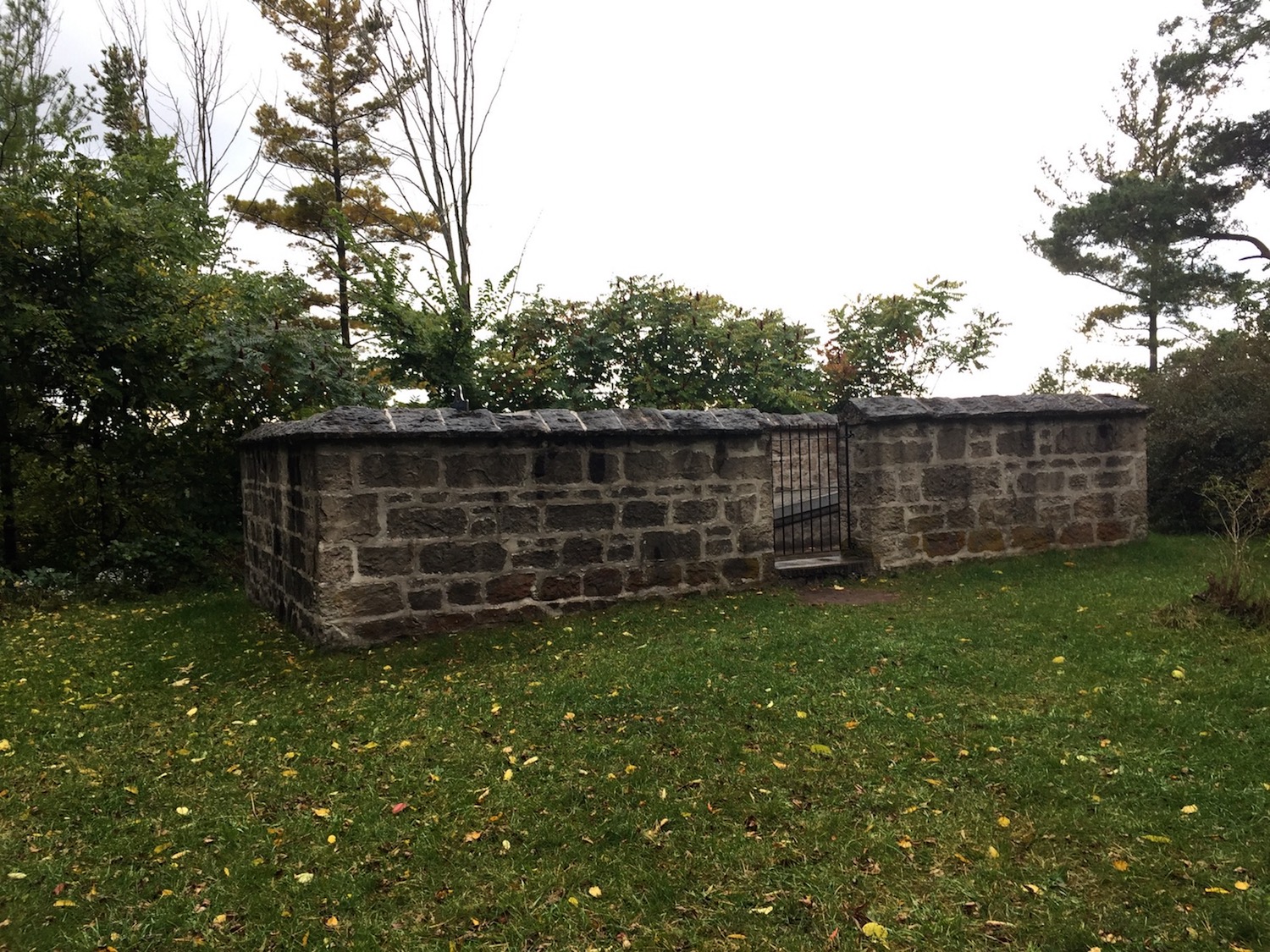
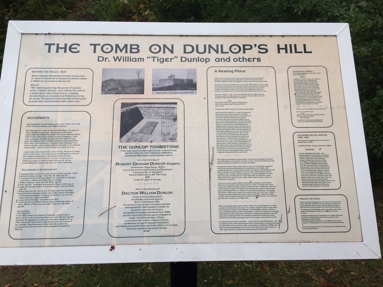
that contains the remains of Tiger.
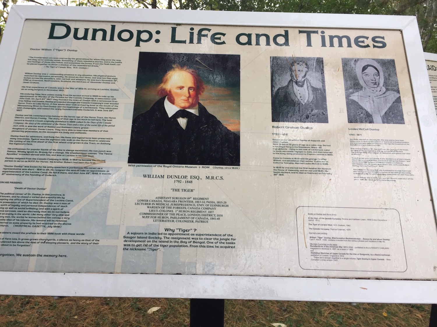
Tiger Dunlop was an interesting character with some colourful notes and an eccentric disposition. You can read more about his antics and achievements here. Did you know that during the Rebellion of 1837 he formed and commanded a regiment that was nicknames The Bloody Useless? A hastily put together group of 600 men that never saw action…
We’ll remind you that together with John Galt he was the founder of Goderich, but Tiger had a vision for a sister town to Goderich, Gairbraid.
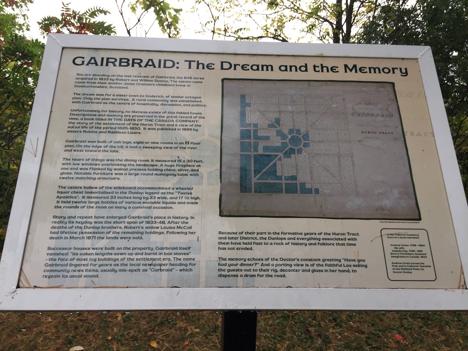
The dream never materialized, and today, only plaques and a couple of lonely tombs remain to tell the story.
Tiger was a visionary and a bit larger than life (apparently in body size as well). What a beautiful spot for a town this would have been.
With Tigers stories echoing around us, we headed back to the van.

Next stop is Bayfield, so stay with us and stay well!
Wonderful pictures of such an interesting place. Laughing waters is such a perfect name for a river.
Thanks, and I agree on the name, although not once did we hear the water laugh 🙂
Very interesting area. And beautiful scenery! Thank you.
Thanks for coming along!
Love that old railway bridge. It looks perfect beside the red fall colours.
It is a striking structure! So glad it was saved from demolition!
It’s weird to think about where a town was meant to be and the reasons for why it didn’t come to fruition.
It is! This reminded me that there was supposed to be a town in the forest in our area a town that was eerily named Seldom Seen. It too, never came to be.
Seldom Seen—sounds like a great title for a book or movie.
It does! I should probably write a post about it at one point 🙂
I love the autumn colours, it’s beautiful. I like the river views and the bridge 🙂
It was a lovely hike. Thanks for visiting with us!
Beautiful terrain. The curved bridge is interesting. I love out of the way places that make you feel like they are your own private spots.
The terrain is partially responsible for this town’s beauty! It does feel like a personal oasis!
Terrific photos! I love the mix of hiking and history!
Thanks! Hiking and history is a perfect mix for me 🙂
You put a lot of work into this post. Loved the pictures. The storm clouds were beautiful as is the river. You included history lessons – liked the first name Tiger. The laughing waters was a perfect name. You must have walked for quite some time. Great post for sure.
Thanks! I don’t think I mention it, but Tiger was actually his nickname. His name was William, and th estory goes that he acquired the nickname Tiger when he worked in India and needed to cull tigers from the plantations…I also loved ther name LAughing Waters!
Interestin nickname Tiger, but I can see why they called him that.
A stormy, but peaceful hike! It’s also impressive you got to learn about the history of the area, especially during notable moments in Canadian history. Thanks for taking us along!
Boots on the ground and a bit of history is what connects us to the places we visit. Thanks for visiting with us!
Agreed, laughing water is a much nicer name for a river. We’re planning on taking a road trip around Lake Huron this summer, I’ll make sure to add these trails and attractions to my itinerary.
That is also in our near plans, providing we can cross the border again. I am very curious to see the US side.
Totally. We would also love to do the same with Lake Superior and see what the landscape and views look like on the US side.
I agree with the others; laughing waters is such a better name. and that is an impressive bridge!
Maybe if our next house will be near water we can name it Laughing Waters Manor 🙂
what a perfect name for a house!
It is interesting to know the origin of places, it gives them more meaning.
It sure is 🙂 I love looking up history of places that we are going to visit. Sometimes we find interesting information about the place after we visit it, and that’s okay too.
Most of regional Australian Railway lines have been turned into walking trail. This is much better than just letting the brambles grow over. There are some lovely similarities between what you see here and those you showed today. It might not be relevant but, as an ex distiller of whisky, I am interested in the red oak, which IS NOT used to make whisky barrels because the timber is porous and all the whisky would end up in the floor.
Perhaps this is why it survived! I love the idea of turning the rail trails into hiking and biking trails.
Looks like a mighty river. Love those fall colours too and the old railway bridge. Wonderful!
Thanks, Miriam! It is a beautiful area!